


Ferme intelligente d’AgConnexi app for iPhone and iPad
Developer: Agrian Inc.
First release : 10 Apr 2019
App size: 71.99 Mb
SmartFarm provides crop advisors and growers with an innovative suite of precision agronomy and compliance tools. Seamless, real-time data syncing and full offline capabilities allow field-based users to remain informed and productive at all times.
NOTE
• Use of this app requires a SmartFarm user account with advanced access.
• Continued use of GPS running in the background can dramatically decrease battery life.
MOBILE DATA MANAGEMENT
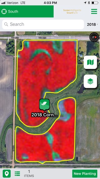
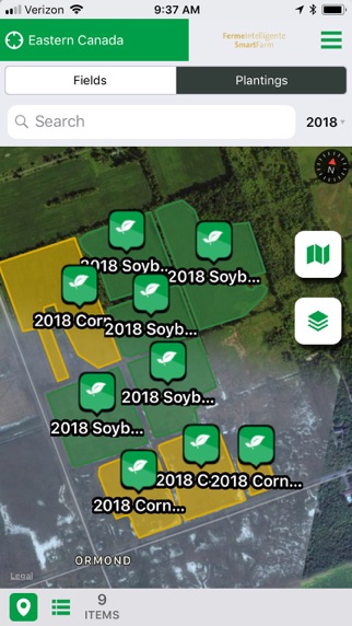
• Create and manage grower, farm, field and planting records and boundary maps
• Full editing capabilities while disconnected in the field
• Boundary mapping with external GPS integration and auto-smoothing capabilities
• Quick and accurate manual mapping with polygon, circle and split drawing tools
• Multiple map background imagery providers (Apple, Google, Bing, etc.)
CLOUD SYNC
• Real-time background cloud sync automatically keeps everyone updated
• Data synced from the device in real-time as records are created while connected
• Data generated while offline is queued and sent automatically once a connection is detected
• Two-way sync keeps all mobile devices in sync within minutes of any change
• Robust permissions model prevents syncing and viewing of unauthorized data
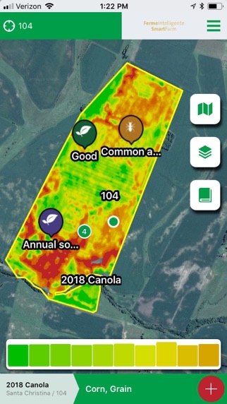
FIELD SCOUTING
• Create geo-referenced scouting observations and attach photos and notes
• Record pest observations for disease, insects and weeds
• Record additional observations for nutrient deficiencies, soil moisture, crop damage and more
• Share observations via text message directly from the field
• Synchronize observations in real time with your co-workers or customers
FIELD SAMPLING
• Offline GPS-enabled soil and plant sample collection
• Grid, zone, target and freeform sampling modes for point and composite samples
• Sample using targets generated from field imagery, logged data (planting, harvest, EM, etc.), soil samples and more
• Request lab recommendations for your sampling job
• Share sample information sheet directly from the field via text message, email and more
IMAGERY / MAP OVERLAYS
• Access in-season imagery for your fields
• Easily view available image dates and switch between layers with a single tap
• View map overlays for planting, application, harvest records and more when scouting or sampling fields
• Utilize location information along with imagery and map overlays for powerful guided scouting
• Access in-season imagery and map layers to validate sample event locations